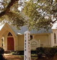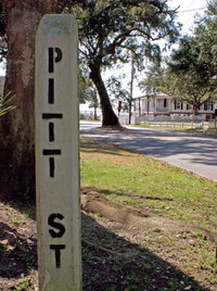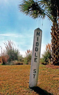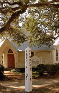
Our Past on a Corner Sign Post
 For the earliest settlers of Mount Pleasant, major routes of transportation included a multitude of harbors, channels, rivers, inlets and creeks surrounding the area. Many of the names that described these waterways originated with the Sewee and Wando Indians. For example: “Shemee” Creek, the “Wando” River and “Sewee” Bay. Other names of water passages spring from European origins such as the Ashley and Cooper rivers.
The first European settlement in Mount Pleasant, in 1680, was on a neck of land surrounded by Charleston Harbor, Shem Creek and Cove Inlet. The Indians called it“Oldwanus” Point, which was later anglicized to “Old Woman’s Point” and finally transformed into North Point—where Old Mount Pleasant is located today. This indian heritage is reflected in some of our current street names, such as Oldwanus Drive, Sewee Circle, Shem Street and Drive, Mataoka Street and Wakendaw Boulevard, to name a few.
As the population of settlers grew, so did their transportation needs. Some of the first roads were built as part of a long distance transportation system that included stagecoaches and ferries. Old Georgetown Road, still in existence, was an early travelers’ route between Georgetown and Mount Pleasant. This route led directly to  the ferry-boat landing and from there folks traveled to Charlestowne across the Cooper River. It was the main passage for mail and travel to and from the north. (It cost passengers 33 cents, horned cattle 21 cents, four-wheeled carriages $1.75). This ferry-line route was used by George Washington when he came to Charlestowne in 1791. Andrew Hibben began the original ferry service in 1770.
The Revolutionary War and later the Civil War also increased the need for transportation of men and supplies. Rifle Range Road was probably the site of a Revolutionary War barracks shown as “barracks in ruins” on a plat dated 1793. This road later led to the U.S. Navy Rifle Range in 1917and was also used by Citadel cadets. The Coast Guard and U.S. regulars from Fort Moultrie traveled down the military sounding Rifle Range Road, as do regular in-town commuters today.
The names on many of Mount Pleasant’s streets came down to us today as a legacy from the town’s early inhabitants, especially in the Old Village area. There is a tradition of honoring those residents who have contributed to the town’s growth and prosperity, a tradition that continues even today. The original settlements or villages dating back to the late 1600’s, were all eventually incorporated to create the town of Mount Pleasant and Greenwich Village. Following is a listing of the original villages and names and origins of the streets that remain part of Mount Pleasant today.
 GREENWICH VILLAGE
The first settlement to become a village, prior to the Revolutionary War. The owner/developer was an Englishman named Jonathan Scott, and the street names reflect this.
KING, QUEEN and PITT Streets
Named for the English sovereigns and a prime minister.
GREENWICH Street
After the village name. This area eventually was incorporated into the town of Mount Pleasant in 1837.
MOUNT PLEASANT VILLAGE
Purchased and developed in 1803 by James Hibben, the only son of Andrew Hibben, who came here from England in 1713.
BEACH Street
Prior to the building of the jetties, this street curved along a sandy beach.
BENNETT Street
Named for James Hibben’s mother-in-law, Mrs. William Bennett.
WHILDEN Street
Named for Elias Whilden, a town planner during the 1837 incorporation. Descendant of original settler John Whilden (1696).
VENNING Street
Named for a village property owner, Nicholas Venning. His father, Colonel Samuel Venning, defended the settlement during the Revolutionary War. This area also incorporated into the town of Mount Pleasant in 1837.
HILLIARDSVILLE
Purchased and developed in 1847 by Charles Jugnot and Oliver Hilliard.Prior to this the land had been swampy and uninhabitable.
FERRY Street
Built as a route to the new ferry company.
MIDDLE and CENTER Streets
Named in the 1847 plan.
McCORMICK Street
Named after H. L. P. McCormick, who bought out the ferry company.
ROYALL Avenue
Changed from “Common Street” in 1950. The Royall family were prominent planters and Robert V. Royall served as town surveyor in 1889 and mayor from 1898-1914. Many direct descendants of this family remain in Mount Pleasant today
HIBBEN FERRY TRACT
Incorporated in 1872.
HIBBEN Street
Named after James Hibben, whose father Andrew Hibben began the ferry service in 1770.
HADDRELL Street
After Haddrell’s Point. George Haddrell was an original settler from the late 1600’s. Lucasville Incorporated in 1872.
MILL Street
Led to the mill on Shem Creek. Now the town of Mount Pleasant stretches from to Charleston Harbor to Shem Creek and beyond. These origins are some of the oldest and most historic streets, but the tradition continues with the ongoing expansion of the town up through modern times.
McCANTS Street
A prominent Mount Pleasant family of planters dating back prior to the Civil War. T. G. McCants was mayor from 1928-1933.
ERCKMANN Drive
Mayor William L. Erckmann served the town as mayor from 1934-1946, during which, Mount Pleasant celebrated its centennial in 1937.
COLEMAN Boulevard
Francis F. Coleman, mayor from 1946-1960. Many improvements to transportation were made during his administration.
A storied chapter in the history of Mount Pleasant ended on August 18, 1929. When the original Cooper River bridge was opened, it eliminated the need for ferries to Charleston, which had been operating for the previous 160 years. More major changes followed, such as the opening of the Mark Clark Expressway and the Isle of Palms Connector. Of course, the future holds even more changes.