Author: Mount Pleasant

East Cooper Daycare Directory

The East Cooper offers parents a variety of daycare and pre-school options. Please call schools for details on service packages and tuition.

Ashley Cooper County Day School
1212 Two Island Court
Mt. Pleasant, SC 29466
(843) 849-9333
Ages: 1 year to the 7th grade
Total number of children: 157
Student/Teacher ratio: approx. 10-1

Charlotte’s Little School House
1135 Bowman Road
Mt. Pleasant, SC 29464
(843) 884-2282
Ages: 6 weeks to 12 years
Total number of students: 70
Student/Teacher ratio: approx. 11-1

Christ Our King Preschool
1138 Russell Drive
Mt. Pleasant, SC 29464
(843) 881-8814
Ages: 2-3 years
Total number of children: 47
Student/Teacher ratio: approx. 6-1

Christ Our King Stella Maris School
1183 Russell Drive
Mt. Pleasant, SC 29464
(843) 884-4721
Ages: 4 years to the 8th grade
Total number of children: 720
Student/Teacher ratio: 25-2, including a teacher’s aid

First Baptist Church School of Mt. Pleasant
681 McCants Drive
Mt. Pleasant, SC 29464
(843) 884-3663
Ages: 3 years to the 11th grade
Total number of children: 350
Student/Teacher ratio: N/A

Montessori of Mount Pleasant
414 Whilden Street
(843) 884-1117

O’Quinn School
955 Houston Northcutt
Mt. Pleasant, SC 29464
(884) 881-8506
Ages: 2-5
Total number of children: 300
Student/Teacher ratio: About 9-1, including teaching assistants

St. Andrews Episcopal Church Day School
440 Whilden Street
Mt. Pleasant, SC 29464
(843) 881-2437
Ages: 3-5
Total number of children: 98
Student/Teacher ratio: 13-2

Sundrops Montessori School
PO Box 782
Isle of Palms, SC 29451
(843) 886-5992
Ages: 3-6
Total number of children: 20
Student/Teacher ratio: 6-1

The Sunshine House
874 Lansing Drive
Mt. Pleasant, SC 29464
(843) 884-7839
Ages: 6 weeks to 12 years
Total number of children: 85
Student/Teacher ratio: 18-1

Woodland Hall Preschool – Kindergarten
946 Whipple Road
Mt. Pleasant, SC 29464
(843) 884-8582
Ages: 2 years to 5 years
Total number of children: 140
Student/Teacher ratio: 10-1

Zion A.M.E. Day Care
4174 N. Hwy 17
Awendaw, SC 29429
Ages: 8 months to 4 years
Total number of children: 21
Student/Teacher ration: 7-1

Local Public Schools

THE EAST COOPER AREA IS PART OF THE CHARLESTON COUNTY
SCHOOL

District’s Moultrie Constituent School District 2, which includes 11 public
schools:
one high school (Wando High),
three middle schools (Thomas Cario, Laing and Moultrie)
and seven elementary schools (Belle Hall, James B. Edwards, Jennie Moore,
Mount Pleasant Academy, Mamie Whitesides, Charles Pinckney, and Sullivan’s
Island Elementary).

Dr. Lynda Davis is the associate superintendent in charge of Moultrie
Constituent District 2. Contact information for the District 2 office
and the main Charleston County School District office is below.

MOULTRIE CONSTITUENT DISTRICT 2
Dr. Lynda Davis,
Associate Superintendent
665 Coleman Blvd.
Mount Pleasant, SC 29464-4017
Phone: (843) 849-2878

CHARLESTON COUNTY SCHOOL DISTRICT
Dr. Maria Goodloe-Johnson,
Superintendent
75 Calhoun St.
Charleston, SC 29401
Phone: (843) 937-6300
www.CCSDSchools.com

ELEMENTARY SCHOOLS

BELLE HALL ELEMENTARY SCHOOL
385 Egypt Road
Mount Pleasant, SC 29464-7200
Phone: (843) 849-2841
Principal: Terri H. Nichols BelleHall.CCSDSchools.com
Enrollment: 739
Average Class Size: Approximately 20
Sends Students To: Moultrie Middle, Cario Middle School Colors: Red, white
and blue
Superlatives: SC Department of Education
Palmetto Gold Award winner 2004-2005.

JAMES B. EDWARDS ELEMENTARY SCHOOL
885 Von Kolnitz Blvd.
Mount Pleasant, SC 29464-3238
Phone: (843) 849-2805
Principal: Thomas Lee
www.JBEdwards.org
Enrollment: 735
Average Class Size: Approximately 22
Sends Students To: Moultrie Middle, Laing Middle School Colors: Blue and
white
Superlatives: Showcase Technology School,
2002-present;
SC Department of Education Palmetto Gold
Award winner 2004-2005.

JENNIE MOORE ELEMENTARY SCHOOL
1256 Hamlin Road
Mount Pleasant, SC 29466
Phone: (843) 849-2815
Principal: Karen Felder JennieMoore.CCSDSchools.com
Enrollment: 603
Average Class Size: 15 in first grade, 22 in others Sends Students To:
Laing Middle, Cario Middle
School Color: Blue
Superlatives: SC Department of Education
Palmetto Gold Award winner 2004-2005;
Arts-Infused Magnet School.

MOUNT PLEASANT ACADEMY
605 Center St.
Mount Pleasant, SC 29464-4901
Phone: (843) 849-2826
Principal: Jane Davis MtPleasant.CCSDSchools.com
Enrollment: 420
Average Class Size: 20-24 in Kaleidoscope program
Sends Students To: Moultrie Middle
School Colors: Blue and white
Superlatives: SC Department of Education
Palmetto Gold Award winner 2004-2005;
named a U.S. Department of Education
National Blue Ribbon School;
oldest public elementary school
in South Carolina.

CHARLES PINCKNEY ELEMENTARY SCHOOL
3300 Thomas Cario Blvd.
Mount Pleasant, SC 29466
Phone: (843) 856-4585
Principal: Leanne Sheppard Pinckney.CCSDSchools.com
Enrollment: 1,430
Average Class Size: Approximately 26
Sends Students To: Cario Middle
School Colors: Red, navy blue, light blue,
khaki and white
Superlatives: SC Department of Education
Palmetto Gold Award winner 2004-2005.

SULLIVAN’S ISLAND ELEMENTARY SCHOOL
1015 I’on St.
Sullivan’s Island, SC 29482-9799
Phone: (843) 883-3118
Principal: Susan King SullivansIsland.CCSDSchools.com
Enrollment: 375
Average Class Size:
Varies by grade level; approximately 15-22 Sends Students To: Laing Middle

School Color: Blue
Superlatives: SC Department of Education
Palmetto Gold Award winner 2004-2005.

MAMIE P. WHITESIDES ELEMENTARY SCHOOL
1120 Rifle Range Road
Mount Pleasant, SC 29464-4229
Phone: (843) 849-2838
Principal: Lona Pounder Whitesides.CCSDSchools.com
Enrollment: Approximately 700
Average Class Size: Varies
Sends Students To:
Cario Middle, Laing Middle, Moultrie Middle School Colors: Navy blue and
gold
Superlatives: Teacher Carol Olney named Wal-
Mart’s National Teacher of the Year for 2004;
SC Department of Education Palmetto Gold Award
winner 2004-2005.

MIDDLE SCHOOLS

THOMAS C. CARIO MIDDLE SCHOOL
3500 Thomas Cario Blvd.
Mount Pleasant, SC 29466
Phone: (843) 856-4595
Principal: Carol Beckmann-Bartlett Cario.CCSDSchools.com
Enrollment: 1,000
Average Class Size: Approximately 30
Sends Students To: Wando High School
School Colors: Blue and silver
Superlatives: Technology Showcase School;
SC Department of Education Palmetto Gold Award winner 2004-2005.

LAING MIDDLE SCHOOL
2213 Highway 17 North
Mount Pleasant, SC 29464-6811
Phone: (843) 849-2809
Principal: Deborah Price
Laing.CCSDSchools.com
Enrollment: 486
Average Class Size: Approximately 24-25 students Sends Students To: Wando
High School School Colors: Maroon and white
Superlatives:
Award-winning band and chorus programs; Outstanding Character Education
Program.

MOULTRIE MIDDLE SCHOOL
645 Coleman Blvd.
Mount Pleasant, SC 29464-4099
Phone: (843) 849-2819
Principal: Jean Siewicki (interim) Moultrie.CCSDSchools.com
Enrollment: 812
Average Class Size: Approximately 25
Sends Students To: Wando High School
School Colors: Blue and white
Superlatives: SC Department of Education Palmetto Gold winner 2004-2005.

HIGH SCHOOLS

WANDO HIGH SCHOOL
1000 Warrior Way
Mount Pleasant, SC 29466
Phone: (843) 849-2830
Principal: Lucy Beckham
www.WandoHigh.com
Enrollment: 2,700
Average Student-Teacher Ratio: 25-to-1
School Colors: Burgundy, black and white
Superlatives: SC Department of
Education
Palmetto Gold winner 2004-2005.
“Tribal Tribune” newspaper named best high school
newspaper in America in 2004.
More students in All-State Band than any other high school.
Latin Team ranked first in state.
SAT Team region champion for five consecutive years.
Warriors won region championships in volleyball,
golf, girls track, girls soccer, boys soccer, girls tennis and boys tennis;

boys soccer team has been ranked at the top of national polls;
swim team is the AAAA state champion.
More than 170 academic course offerings,
73 clubs and organizations, and 32 athletic teams.

Sources: Charleston County School District website
(www.CCSDSchools.com); individual schools and
their websites
.

Shem Creek, Mount Pleasant

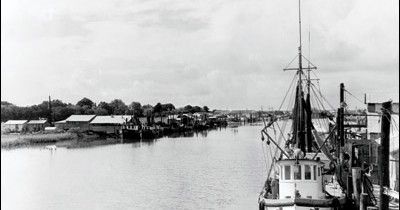
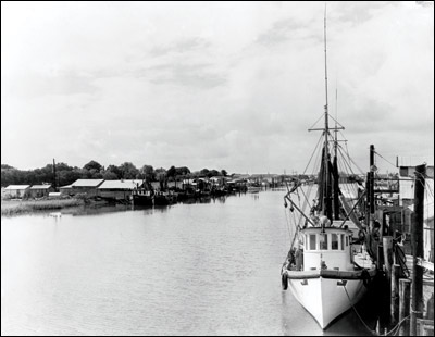
Shem Creek has always been a working creek. It fed the Sewee Indians and ferried the father of our country safely across the harbor. It powered saw mills and rice mills and served up turtles whose meat won acclaim at fine restaurants in the Northeast.

It pumped money into Mount Pleasant’s economy with every net full of shrimp that its trawlers hauled back to the docks. And it worked magic for children, opening its arms to generations of little boys and girls who paddled into the creek holes, imaginations brimming, searching for adventure and buried treasures.

Shem Creek is still a working creek today, although much of the work has changed. It still feeds people, but today they’re mostly guests at the restaurants alongside the docks. Boats still come and go, but today the watercraft is more recreational than commercial.

Yet despite changing tides and times, Shem Creek still provides a livelihood, a playground and a sense of place. It’s the village’s touchstone — a picture-postcard place that still and always captures the heart and soul of Mount Pleasant.

Bricks, Buckets, Ferries and Fleets

The Indians are thought to have called it Shemee, possibly for a small tribe that lived on its banks. Shem Creek, whose head is near present-day Bowman Road, was commonly known in the 1700s by the name of the men who owned the land alongside it. It was Sullivan’s Creek (for Capt. Florence O’Sullivan, the patriot for whom Sullivan’s Island is named), Dearsley’s Creek (for George Dearsley, thought to have been one of the first shipbuilders on the creek) and Parris Creek (after Alexander Parris, who also owned land near Beaufort where the Parris Island U.S. Marine facilities are today).

Shipbuilding made Shem Creek a working creek, but it was far from the only activity there. Peter Villepontoux ran a lime kiln on the creek in the 1740s to supply the growing number of brickyards in the Lowcountry. Between 1745 and the start of the Civil War in 1861, more than 50 brickyards had operations on the Wando and Cooper rivers.

Ferry service made Shem Creek a hub of business as well. In 1770, Englishman Andrew Hibben bought a charter to run a ferry from the south side of Shem Creek to Charleston. Hibben’s Ferry was the first to connect Haddrell’s Point (the name given to the Old Village area after colonist George Haddrell) with the city of Charleston; other ferries had run from Hobcaw Creek. Hibben charged 33 cents for passengers, 21 cents for horned cattle, 75 cents for two-wheeled carriages and $1.75 for four-wheeled carriages.

In 1791, when President George Washington visited the South Carolina Lowcountry as part of his “Southern Tour,” Major Peter Bocquet provided him with a special barge that was refurbished and lengthened at Pritchard’s Shipyard on Hobcaw Creek. A dozen captains — one from each of the 12 American ships anchored in Charleston Harbor at the time ­­— were invited to man the oars for the president’s crossing of the channel. A flotilla accompanied the presidential barge across the harbor, with crowds cheering and bands on several vessels providing music for the celebration.

In 1795, millwright and inventor Jonathan Lucas built a combination rice mill/saw mill on Shem Creek — the first water-driven rice mill in the area. The man and his work live on in the names of the thoroughfares along the creek — Mill Street and Lucas Street. Lucas’s mill was on the site of an earlier mill called Greenwich Mill, built by landowner Jonathan Scott. In the mid-1800s, John Hamlin’s Mount Pleasant Bucket Factory on the south side of the creek, in the area of present-day Live Oak Drive and Bennett Street, supplied not only buckets, but painted and unpainted pine, cypress, assorted lumber, and lathes as well.

War on the Creek

The Civil War touched Shem Creek, just as it did the rest of the Charleston area. In the early 1860s, workers at Jones Shipyard on the creek had built a steamer called The Planter that owner F.M. Jones intended for use by nearby plantations. The vessel was instead put into service as a blockade runner for the Confederacy because of its shallow draft and speed. On May 13, 1862, while the vessel’s white officers were ashore, The Planter’s black quartermaster, Robert Smalls, and the rest of the all-black crew saw their opportunity and seized it. Smalls and his fellow sailors steered the ship out to meet Union vessels at the mouth of the harbor and were later rewarded for their daring.

At the time of the war, there was a grist mill on Shem Creek in the area that is now the Shemwood II subdivision. The mill ground rice and corn grown on local plantations. In February 1865, Mount Pleasant’s intendant (mayor), Henry Slade Tew, wrote a letter to his daughter telling her of the ill fate that befell the mill:

“I heard that orders had been given to burn the mill and contents, and about 1,200 bushels rough rice of which near 200 was my own, and I had also the stores for the poor in it. I regarded this as a wanton act of cruelty, as ours was an isolated community having no local source of supply, and all that was in the mill would not have afforded more than would suffice to feed them a month or two, and the destruction of the mill itself would deprive the people of a means of having any rice beat or corn ground, and must cause great suffering.”

Tew went to mill to try to stop the burning, appealing personally to Capt. C.P. Bolton and his cavalry as they approached bearing torches. “He (Bolton) admitted the cruelty of the act, knew from his long service at this post that the mill was the only source for the inhabitants to prepare their grain for food, but his orders compelled him to destroy it, and fire was accordingly applied, and the devilish act, I must call it, accomplished.”

Terrapins and Trawlers

More than two decades after the war ended, the modern seafood and boat building industries on Shem Creek were born. In 1890, William Hale was operating an oyster factory on the creek, and in 1895, Capt. Robert Holman Magwood bought the Mount Pleasant Boat Building Co., docking his boats there and also operating a turtle crawl. The “Cooter Pen” shipped live diamondback terrapins to the larger cities in the Northeast, where they appeared on the menus of the finest hotels.

By the 1930s, though, shrimping and boat building were the major industries on the creek. The Darby family bought Mount Pleasant Boat Building in 1921 and the business thrived, specializing in engine installation, repairs and equipment sales as well as construction. When the company closed in 1990, the boat building business ceased on the creek.

The shrimping industry continues at Shem Creek, although it faces pressure from cheap foreign imports, development on the creek, and the lack of ready supplies of two critical ingredients for the trawlers — ice and fuel. In the 1930s, Capt. William C. Magwood introduced the first powered trawler on the creek, the Skipper, and the Magwood family today is still a staple of the local seafood business. Also a fixture on the creek is Mount Pleasant Seafood, established in 1945 by W.D. Toler. His son-in-law, Rial Fitch, has owned the business since 1975 and has had a front-row seat for the changes on the creek.

“The biggest change I’ve seen is the growth and upcropping of the restaurants,” Fitch says. “Originally there was just the Lorelei, then the Trawler, and then the others started coming — RB’s, The Barge. Down at the other end there’s Shem Creek Bar and Grill, and next to them — I can’t even remember all the others.

“Right behind that is the change from having all-commmercial and all-working boats to so many recreational and pleasure boats,” he says. “There used to be from 100 to 120 shrimp trawlers that frequented the creek at different times and unloaded between Simmons Seafood, Mount Pleasant Seafood, the Magwoods and all the different docks. Now there are probably 20 to 25. There are still a lot of people who go out on the creek to make a living, but it’s not as much a commercial creek as it was.”

Fitch grew up in downtown Charleston. “My earliest recollection of Shem Creek is coming across on the way to the Isle of Palms to see my aunt who lived over there, and every time you went across you could smell the seafood. I don’t remember seeing all the boats or anything else, but I remember you could smell the seafood.”

Like many longtime residents, Fitch recalls the shrimp house or “heading house” on the creek, where shrimp were processed before being sold. “It closed before Hugo, I’d say in the early ’80s, but in the late ’70s it was still real vibrant,” says Fitch. “There was what they called the Big White Truck, and it used to ride around and pick up the headers and bring them to the shrimp house, and then at 12, 1, 2 o’clock in the morning, they’d load everybody back up and take them home and do it all again the next day. That was seven days a week during the shrimp season.”

There were jobs there by the hundreds, but the pay was poor. “The headers got just pennies a pound — I think it was 10 cents a pound when they closed,” he says. “You’d head 100 pounds of shrimp and end up with $10.”

In 2002, the Town of Mount Pleasant appointed a special Shem Creek Management Committee to “determine a vision and outline issues of importance to the future of Shem Creek.” After several months spent gathering opinions and information from business owners, residents, environmental experts and others with an interest in the creek, the group issued its report. The conclusion? Simply this: “Overwhelmingly, the consensus was that the character of the creek remain as it is — natural, water-dependent, charming — a ‘working’ creek.” Which is what Shem Creek always has been — and, one way or another, always should be.

Memorial Waterfront Park

On the bank of the Cooper River at the mouth of Charleston Harbor, and close to Tides Condominiums Charleston Harbor you will find the latest jewel in the crown of historic Mount Pleasant, the town’s most recent and grandest contribution to community recreation and civic pride – Memorial Waterfront Park. Conceived as a family-friendly addition to Mount Pleasant’s already extensive parks and recreation program and as a tribute to area residents who have died in the service of their country, Memorial Waterfront Park offers a wide array of opportunities both for pleasure and for quiet contemplation.
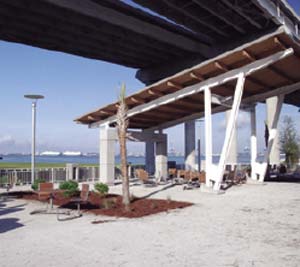
Many years in the planning, the 22-acre park was built at a cost of $14 million and opened to the public on July 4, 2009. One of its most impressive features is its 1,250-foot fishing and pedestrian pier, the longest such facility in the Lowcountry and one of the longest in the Southeast. The pier is constructed of tabby concrete – oyster shells mixed with concrete – an important, traditional building material throughout the Charleston area.

Fun, Fishing and a Shrine to Fallen Heroes

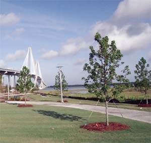
Partly as a practical matter but also as homage to the past, the pilings that supported what was once the Silas Pearman Bridge were cut down and now form the base of the Memorial Waterfront Park pier. East Cooper residents now travel to Charleston on the Arthur Ravenel Jr. Bridge, a spectacular span opened in 2005 that rises above the park and provides welcome shade from the sometimes scorching South Carolina sun. The dominant feature of the park is its colorful and innovative children’s area. Well-lighted and featuring numerous security cameras, the playground boasts a host of unusual and safety-oriented attractions for the kids and comfortable seating areas nearby for their parents. The perimeter of the playground is discreetly fenced, with access only to the rest of the park, not to nearby roads or parking areas.

As a tribute to Mount Pleasant’s heritage as a home port for working shrimpers, the playground features a kids’ shrimp boat, part of a complex of bridge-like structures that mimic the Ravenel Bridge overhead. These bridge-like structures are complete with slides, stairs and netting attached to the shrimp boat so kids can climb easily from one to another. Beneath it all is a light blue rubber pad, for safety and to represent the blue waters that surround Mount Pleasant.

At the park, a tidy shop sells snacks, gifts and tackle and rents fishing gear for use on the pier, and there are plenty of restrooms and picnic areas, as well as a visitors’ center. A sweetgrass pavilion educates visitors about the Gullah tradition of sweetgrass basket making and to honor the artisans who continue that tradition today along a designated section of U.S. Route 17.

As the park’s name suggests, its outstanding feature is the memorial itself. Dedicated to the serviceman and women from Mount Pleasant and its precursor, Christ Church Parish, who lost their lives fighting for the cause of freedom, it was created at a cost of nearly $1 million. The memorial includes a reflective pool, brick-lined paths and a sculpture by celebrated artist Raymond Kaskey, whose other architectural sculptures include the National World War II Memorial on the Mall in Washington, D.C. Kaskey’s Mount Pleasant work is a bronze female figure representing contradictory emotions of loss and hope. In her left hand, she holds a tri-folded flag – similar to the one presented to grieving widows and mothers. Her right hand rests upon a World War II helmet, supported by a rifle.

For family fun, fishing, an evening of entertainment or the opportunity simply to relax and reflect, Memorial Waterfront Park is a special attraction in a town that thrives on offering its residents and visitors nothing but the best.

Charleston Invisalign Orthodontists

McClellanville, South Carolina

If you could design the perfect spot to settle down and enjoy life, it would look a lot like McClellanville.

Just off Highway 17, about midway between Myrtle Beach and Charleston, McClellanville is a tiny fishing village on the banks of Jeremy Creek. Residents live in a mix of modern homes and old-fashioned two-story houses with welcoming porches.
Though it is small, it is a town with a big heart. Together, the townspeople survived the terrible wrath of Hurricane Hugo in 1989, then rebuilt the homes and businesses that were blown away. Today, local residents welcome newcomers who seek the peace and serenity of small-town living along with the convenience of residing just a short distance from major metropolitan areas.

It takes just a few minutes to drive around McClellanville, but, once you do, you’ll want to become a permanent part of this vital community. Be sure to stop at the business district, in the heart of the village, where you’ll find eclectic boutiques offering clothing, gifts and pottery. For fresh seafood, have a seat a TW Graham & Co., where the locals meet to eat and catch up on the news. The Crabpot Restaurant, on Highway 17, is another favorite stop for residents and hungry travelers.

“ Together, the townspeople survived the terrible wrath of Hurricane Hugo in 1989, then rebuilt the homes and businesses that were blown away. ”

Lest you think there’s not much to do beyond a daily walk, The McClellanville Arts Council might change your mind. A non-profit chartered in 1977, the group is dedicated to enhancing culture in their corner of Charleston County. For three decades, the Arts Council has presented hundreds of events and programs, ranging from book signings to batik classes to African dance classes. In 1997, Gov. David Beasley and the South Carolina Arts Council honored the McClellanville Arts Council with the Elizabeth O’Neill Verner Award.

The Village Museum, also downtown, presents McClellanville’s history, from the rice plantations along the Santee Delta through today’s seafood industry.

Surrounded by the Cape Romain Wildlife Refuge, the Francis Marion National Forest and the Santee Coastal Reserve, the small fishing village of McClellanville is the perfect refuge from the outside world.

Map of McClellanville, SC


View Larger Map

Move to Mount Pleasant, SC

Our Past on a Corner Sign Post

For the earliest settlers of Mount Pleasant, major routes of transportation included a multitude of harbors, channels, rivers, inlets and creeks surrounding the area. Many of the names that described these waterways originated with the Sewee and Wando Indians. For example: “Shemee” Creek, the “Wando” River and “Sewee” Bay. Other names of water passages spring from European origins such as the Ashley and Cooper rivers.
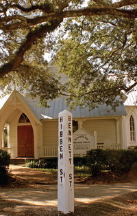
The first European settlement in Mount Pleasant, in 1680, was on a neck of land surrounded by Charleston Harbor, Shem Creek and Cove Inlet. The Indians called it“Oldwanus” Point, which was later anglicized to “Old Woman’s Point” and finally transformed into North Point—where Old Mount Pleasant is located today. This indian heritage is reflected in some of our current street names, such as Oldwanus Drive, Sewee Circle, Shem Street and Drive, Mataoka Street and Wakendaw Boulevard, to name a few.

As the population of settlers grew, so did their transportation needs. Some of the first roads were built as part of a long distance transportation system that included stagecoaches and ferries. Old Georgetown Road, still in existence, was an early travelers’ route between Georgetown and Mount Pleasant. This route led directly to the ferry-boat landing and from there folks traveled to Charlestowne across the Cooper River. It was the main passage for mail and travel to and from the north. (It cost passengers 33 cents, horned cattle 21 cents, four-wheeled carriages $1.75). This ferry-line route was used by George Washington when he came to Charlestowne in 1791. Andrew Hibben began the original ferry service in 1770.

The Revolutionary War and later the Civil War also increased the need for transportation of men and supplies. Rifle Range Road was probably the site of a Revolutionary War barracks shown as “barracks in ruins” on a plat dated 1793. This road later led to the U.S. Navy Rifle Range in 1917and was also used by Citadel cadets. The Coast Guard and U.S. regulars from Fort Moultrie traveled down the military sounding Rifle Range Road, as do regular in-town commuters today.

The names on many of Mount Pleasant’s streets came down to us today as a legacy from the town’s early inhabitants, especially in the Old Village area. There is a tradition of honoring those residents who have contributed to the town’s growth and prosperity, a tradition that continues even today. The original settlements or villages dating back to the late 1600’s, were all eventually incorporated to create the town of Mount Pleasant and Greenwich Village. Following is a listing of the original villages and names and origins of the streets that remain part of Mount Pleasant today.

GREENWICH VILLAGE
The first settlement to become a village, prior to the Revolutionary War. The owner/developer was an Englishman named Jonathan Scott, and the street names reflect this.

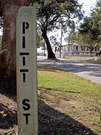
KING, QUEEN and PITT Streets
Named for the English sovereigns and a prime minister.

GREENWICH Street
After the village name. This area eventually was incorporated into the town of Mount Pleasant in 1837.

MOUNT PLEASANT VILLAGE
Purchased and developed in 1803 by James Hibben, the only son of Andrew Hibben, who came here from England in 1713.

BEACH Street
Prior to the building of the jetties, this street curved along a sandy beach.

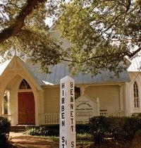
BENNETT Street
Named for James Hibben’s mother-in-law, Mrs. William Bennett.

WHILDEN Street
Named for Elias Whilden, a town planner during the 1837 incorporation. Descendant of original settler John Whilden (1696).

VENNING Street
Named for a village property owner, Nicholas Venning. His father, Colonel Samuel Venning, defended the settlement during the Revolutionary War. This area also incorporated into the town of Mount Pleasant in 1837.

HILLIARDSVILLE
Purchased and developed in 1847 by Charles Jugnot and Oliver Hilliard.Prior to this the land had been swampy and uninhabitable.

FERRY Street
Built as a route to the new ferry company.

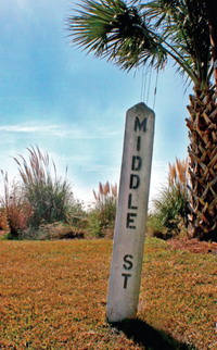
MIDDLE and CENTER Streets
Named in the 1847 plan.

McCORMICK Street
Named after H. L. P. McCormick, who bought out the ferry company.

ROYALL Avenue
Changed from “Common Street” in 1950. The Royall family were prominent planters and Robert V. Royall served as town surveyor in 1889 and mayor from 1898-1914. Many direct descendants of this family remain in Mount Pleasant today

HIBBEN FERRY TRACT
Incorporated in 1872.

HIBBEN Street
Named after James Hibben, whose father Andrew Hibben began the ferry service in 1770.

HADDRELL Street
After Haddrell’s Point. George Haddrell was an original settler from the late 1600’s. Lucasville Incorporated in 1872.

MILL Street
Led to the mill on Shem Creek. Now the town of Mount Pleasant stretches from to Charleston Harbor to Shem Creek and beyond. These origins are some of the oldest and most historic streets, but the tradition continues with the ongoing expansion of the town up through modern times.

McCANTS Street
A prominent Mount Pleasant family of planters dating back prior to the Civil War. T. G. McCants was mayor from 1928-1933.

ERCKMANN Drive
Mayor William L. Erckmann served the town as mayor from 1934-1946, during which, Mount Pleasant celebrated its centennial in 1937.

COLEMAN Boulevard
Francis F. Coleman, mayor from 1946-1960. Many improvements to transportation were made during his administration.

A storied chapter in the history of Mount Pleasant ended on August 18, 1929. When the original Cooper River bridge was opened, it eliminated the need for ferries to Charleston, which had been operating for the previous 160 years. More major changes followed, such as the opening of the Mark Clark Expressway and the Isle of Palms Connector. Of course, the future holds even more changes.

The Arthur Ravenel Jr. Bridge

I resisted the temptation to drive the new Arthur Ravenel Jr. Bridge the first day it opened to traffic. Well, I did until dinner time. My daughter, Sam, and I had gone out for a salad at an eatery around the corner. On that two-minute drive home, I said, “Do you want to drive over the bridge?”
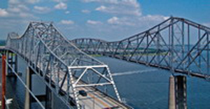
A quick nod and we drove into history, along with thousands of other people eager to share our experience. I’d never seen bridges like this before I moved to Charleston in the ‘70s.

The Pearman was still relatively new,a modern marvel with a reversible lane and the signals to prove it. It seemed a pretty sturdy way to get to what was then advertised as “the tomorrow side of the river.” The problem with going to Mount Pleasant—or the beaches— was the return trip. The Grace Bridge both fascinated and frightened me.

Believe me when I say I found the trip truly heart-stopping. I sat, paralyzed, holding onto the passenger seat with both hands. I tried holding onto the door handles, but thought better of it. In the ‘70s, cars didn’t have safety features. To clutch the door handle was to potentially fling myself out of the car altogether. I didn’t dare breathe until we were safely approaching the East Bay Street exit.

My then-husband thought my fear was ridiculous. He shook his head as he zipped in and out of traffic on those two pitifully narrow lanes. I was scared beyond belief as I watched the railings flash by so close I could have touched them—if I could have opened the window.

“Just don’t look,” he said. “Close your eyes and it won’t be a problem!” It sounded like a good idea at the time, but this is even worse than eyes open. Much worse! I squeezed my eyes shut, sat back and relaxed for what I know was a small eternity. I carefully opened my eyes only to discover that we had moved forward perhaps 20 feet. That meant we still had about two-and-a half miles to go before I could breathe again.
Over the years, my fear of driving across the “old” bridge became legend. At first, only my family was aware—as in “Now children, Mommy is driving across the bridge, so we need to be very, very quiet so that we won’t accidentally drive off.”

Believe me, you could have heard a pin drop in that car. Other times I’d suffer panic attacks —is this how a stroke feels, I wondered? Even in the dead of winter, my hands were slick with sweat as I tried to maintain my grip on the steering wheel. Finally, a few years ago, I decided to give up driving on the Grace altogether. I became a laughing stock among my friends and co-workers when I requested they drive me across the reversible lane to downtown.

Funnily enough, it was only the Grace Bridge that bothered me. I actually loved driving over the “new” bridge, the Pearman. Just as high, with views just as spectacular, crossing that bridge counted as a great Lowcountry drive unless, of course, you were unlucky enough to be stuck in the rushhour traffic or the aftermath of a stalled car or accident.

When I first heard about the construction of a new bridge, I didn’t believe it would come about any time soon. Things move exceedingly slow, at best, in Charleston. Something as expensive and massive as this bridge could surely never be built during my lifetime. I was wrong. The Arthur Ravenel Jr. Bridge began to rise from the river bed.

At first, there was not much to see but before long, the towers were touching the sky as hundreds of workers toiled round-the-clock to close the gaps. It stood silently by—a masterpiece of man and equipment—as traffic continued to flow north and south a stone’s throw away. During the last few months, as the spans edged closer together, I could feel the excitement mounting. With each day, a few more inches were gained. I knew the builders, from the crew leaders to the lowliest workers, must have been bursting with pride at their accomplishment. I could hardly wait to get on the new bridge myself after watching the construction all those many months.

Though it was hot as the dickens, I rode the school bus up to the center of the bridge to join the thousands of walkers. I became one of the gawkers, marveling at the amazing views and snapping photos against the backdrop of the bridges, both new and old. For the first time ever, I looked at the top of the superstructure on the old bridges. And as I walked, I realized the bridge had been waiting, too—waiting for the people of the Lowcountry to breathe life into it. But, as it awakened that weekend, I couldn’t help but feel a tug of sadness for the two old ladies whose lives were ebbing away. I’ve been driving the “Cuzway,” as it is fondly known to locals, for about a year now and I can tell you one thing: it is a wonderful thing to behold.

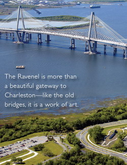
The Ravenel is more than a beautiful gateway to Charleston—like the old bridges, it is a work of art. But the best part? It’s so big and wide, I never feel scared at all. I have finally conquered the bridge.

Marais at Seaside Farms, Mount Pleasant, SC

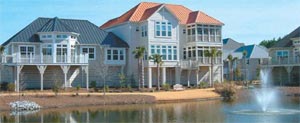
Marais at Seaside Farms is located in beautiful Mt. Pleasant, S.C., just minutes from Isle of Palms. The convenient proximity of this intriguing marsh community offers residents an “atypical architectural design,” said Gene Styles, a resident of Marais at Seaside Farms. Constructed by Gulf Stream Construction Company, a subsidiary of the developer, THE BEACH COMPANY, Marais at Seaside Farms offers a relaxing lifestyle that is unique to residents and the community of Mt. Pleasant.
“Marais is a place where we have the best of both worlds,” said Styles.

“Our lifestyle is typical of retirement living. We want standard amenities, plus closeness to the beach, golf, shopping and other forms of recreation,” said Styles. “The convenience and availability of these factors, combined with an affordable price, were primary considerations.”

The Styles family chose a three-bedroom, three-bath design on two levels.

“One bedroom and bath are located on the main floor with the kitchen, dining room and family room. When guests visit, it is important for them to feel comfortable and to have a suite all to themselves. We chose to purchase a town home because we did not want the responsibility of exterior upkeep and maintenance.”
Another resident of Marais enjoys the “close proximity to the beach and the easy access to Highway 17.”

“Marais is a very quiet community with a style of its own,” she said. This Marais resident has enjoyed living there for more than a year. The unusual style of Marais’ town homes, with the feel of being more like a home than a condo, is what attracted her. She chose the Drayton, a single level floor plan, complete with three bedrooms and two-and-a-half baths. The 17-foot ceilings in the great room and full-length and transom windows make it feel spacious.

“The interior has pine floors, with the exception of the bedrooms. The ceilings are high and the walls are soundproof. I have never heard my neighbors. THE BEACH COMPANY and Gulf Stream did an excellent job developing and constructing Marais. I am proud of my town home and I love being a part of such a safe and lovely community,” said the Marais owner.

Available upgrades include decks, screened porches, fireplaces, built-in cabinets, granite counter tops, and sunrooms. A grand pool and bathhouse are available for exclusive use of Marais’ owners. One of the many intriguing features of the Marais at Seaside Farms development is that each unit has its own personality and charm.

The area is tastefully landscaped and residents are not responsible for ground maintenance. For many residents, this is a critical factor since taking care of a lawn and gardening can be tedious tasks. Marais residents are most pleased with their life style in Marais at Seaside Farms.

“We have the best of both worlds with our town house at Marais, which is our primary residence,” Sayles said. “We enjoy the mix of residents professionals, young families and retired. Marais at Seaside Farms is a wonderful place to live and enjoy a relaxing lifestyle.”

Beresford Hall, Daniel Island, SC

Rick Mullin, Vice President and Charleston Area Manager for Simonini Builders, can hardly mask his enthusiasm once you get him warmed up talking about Beresford Hall, a new waterfront community just off Clements Ferry Road North on the Cainhoy Peninsula. “Beresford Creek is a major tributary of the Wando River, and it’s one of the prettiest and most pristine bodies of water in the Charleston area,” he says. “To call it a creek is deceptive; it’s a significant body of water, and it offers deep-water access.” Looking from the community pier, stretching out over the broad expanse of marsh and the river beyond, it’s hard to argue with him. And it’s quiet. Country quiet. Remarkably, Beresford Hall is also only minutes away from I-526, downtown Charleston and Mount Pleasant, and one exit from the amenities of Daniel Island.

Still, it’s easy to forget the hustle of city life once inside the gates of the community. Words such as community and neighborhood are often heard when talking to anyone involved with Beresford Hall. It’s obvious that everything was planned with community in mind—not community in the simple sense that it contains houses, but community as a philosophical concept. Having built three houses there, Ernie Diloreti, owner of Diloreti Construction, summarizes, “It is just a well-planned, family-centered community.” Good luck finding someone involved who refers to Beresford Hall as a development.

Grange Cuthbert, who is with Prudential Carolina Real Estate, says that the developer, Greenwood Development, is rare because unlike so many developers, “they don’t try to cut costs just to make more money.” For example, he points out that John Morgan, project manager for Greenwood, identified 581 “grand trees” on the 600-acre property. From the very start, John vowed to save every one of them, and he did—at no small expense. “It would have been a lot easier and less expensive to cut some of them, but he didn’t,” says Grange, who was so impressed with the master plan for the community that he decided to build a house there himself. “Having worked with Greenwood in the past, I knew that they would fulfill all their promises,” he adds.

Beresford Hall offers plenty of elbowroom. Lots are at least three quarters of an acre, while some go as high as three. “Most developers would have squeezed many more lots out of a property this size, but that was not Greenwood’s vision,” Grange points out. Lots range from deep-water sites with piers to interior lots overlooking ancient fields (one of which predates the colonial era) lined with ancient moss-draped live oaks. In addition to lot size, Ernie points out that required natural curtains and clearing guidelines for each lot enhance both privacy and the rural attitude of Beresford Hall, plus there are numerous permanent green spaces, such as an eight-acre meadow and five parks dotted throughout the community.

The fields and oaks are living artifacts of land that boasts a rich history. First hunted and farmed by American Indians, the land was deeded to Richard Beresford in 1706. Over the years, the site has witnessed brickworks that supplied the Charleston market (piles of these early manufactures rest where they were left near the community pier), the unsuccessful cultivation of silk and the genteel pursuit of Lowcountry game.

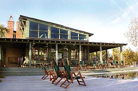
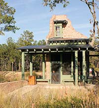
Today, the epicenter of Beresford Hall is the community center—“The Ruins”—cunningly designed to reflect a ruined 18th-century brick plantation house. Designed by preeminent architect Jim Thomas, the center features a large pool pavilion with a rustic lodgelike dining room and deep porches with an enormous covered grill and outside fireplace. The adjacent swimming pool overlooks the marsh. Rearward and to the side of the center, the icehouse—a smaller architectural “ruin”—shelters a commercial ice machine and sits beside the community boat launch, convenient for fishing, skiing or a sunset cocktail cruise.

From a builder’s perspective, both Rick and Ernie agree that one of the most attractive benefits of Beresford Hall is its relatively high ground. Some lots are as much as 20 feet above sea level. “I even have one that’s pushing 30 feet—an unusual feature in coastal South Carolina,” Rick says. He adds that having such high ground in a waterfront community is a marked advantage for builders because it invites so many more fl oor plan options. “In many cases, we are able to build out instead of up, providing grand living on a single level,” he explains.

Beresford Hall promises other activities in addition to water sports. Eight miles of walking trails and sidewalks accommodate biking and observing nature. For all its privacy, Beresford Hall’s parks and ponds, as well as a central post offi ce and the Grand Council Mall, reinforce the emphasis on family and community.

Young families in Beresford Hall will send their children to the soonto- be-opened Daniel Island Elementary School. Being part of this school reinforces Beresford Hall’s relationship with Daniel Island and all its amenities, but within a rural context.

Although there is no architectural master plan for the community, a strict building review board assures that all architectural plans relate to Beresford Hall’s Lowcountry character. “The review board here is tougher than in other places we’ve built,” Ernie claims, “and that adds to the value of the neighborhood.”

In keeping with such high standards of quality, Ernie pays special attention to details that make each house he builds in Beresford Hall unique. For example, he’s included cherry cabinets, made in Diloreti’s own workshops, in some kitchens. “Nobody will be able to walk into one of our kitchens and say, ‘Oh, I have that,’” he says.

An ardent student of Lowcountry architecture, Rick points out that although this vernacular style is simple, the details are meticulous. “The proportions of dormers, the alignment and entablature of columns and porches, the casings and head conditions of windows—attention to all these authentic details are not something an untrained observer can immediately identify, but those with a good eye recognize design when its done right,” Rick says. “Charleston is one of three major colonial centers with a rich architectural history,” he adds, “and I have an obligation to see that these traditions are executed faithfully in every house we build here.” Such a testimony should be no surprise coming from someone building houses in a community dedicated to the smallest details. As Grange puts it, “The clubhouse, post office, green spaces, parks, granite curbs—you rarely find such quality details in neighborhoods being built today.”

Mount Pleasant MLS Search

Hibben in Mount Pleasant’s Belle Hall

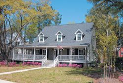
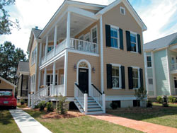
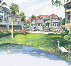
Located in Belle Hall Plantation just minutes from I-526 in Mt. Pleasant, the community of Hibben is a peaceful respite from the stress of daily life. Reminiscent of a traditional small Southern village, the streets of Hibben meander around grand oaks, saltwater marshes, community green spaces and nature preserves.

Covering more than 110 acres and overlooking the Wando River, Hibben shares community amenities, including an Olympic-sized pool, tennis courts, playgrounds and a state-of-the-art clubhouse, with the neighboring subdivisions in Belle Hall Plantation. Hibben, which eventually will include 300 homes, offers a wide variety of wooded home sites. Future phases of the subdivision will feature more than 40 marsh- or creek-view lots.

While traditional neighborhood developments are urban in theory, public opinion surveys have indicated that prospective homeowners want more green space. All home sites at Hibben are at least 10 feet wider and 10 feet deeper than lots at other traditionally designed neighborhoods. This makes it easier when searching for Mount Pleasant neighborhoods to make a good, solid choice.

“At Hibben we are sensitive in how our homes relate to the environment,” said Mark Regalbuto of Crescent Real Estate, which is marketing Hibben. “We want to retain as much of the natural pristine beauty as possible.”

Conceptualized as a traditional neighborhood design, Hibben’s real focus is its authenticity, balanced with affordability. Floor plans, in a variety of period styles, capture the true feeling of small-town Southern charm. While traditional neighborhood design is conducive and appealing to an eclectic, diverse grouping of people, in practice it is very expensive to develop. Most traditional neighborhood developments demand authenticity in every respect, driving up not only construction expenses but also long-term home maintenance costs.

Hibben, on the other hand, has chosen a true traditional neighborhood design but with modern construction materials to reduce costs. For example, instead of exterior wood siding, which is costly to install and maintain, Hibben uses cement fiber siding such as Hardiplank, which offers the distinctive look of wood combined with low maintenance and durability. These economics-based measures allow Hibben to adhere to architectural guidelines governing style while still providing the affordability that draws a wide variety of homeowners.

Since Hibben appeals to newlyweds, executives, young families with children and empty-nesters looking to downsize, homes vary in size from 1,400 square feet to 4,000 square feet. And with new home construction costs ranging from $150 to $165 a square foot, Hibben offers an affordability that is hard to find in Mt. Pleasant.

Simonini Builders, The Lantana Company, Driftwood Construction, Palladio Homes, Heyward Builders, Robert Benjamin Homes, Custom Homes of Carolina and Airlie Homes are some of the outstanding preferred builders available to help prospective homeowners with all their construction decisions.